

KIM TAEHEE
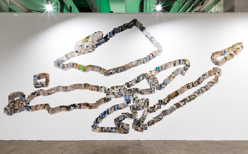
Île de Nantes is at the center of Nantes.
The formation of these islands has changed over the years, in the process of building several bridges of soil and cement that now connect them.
Search the strata of this space containing the history of Nantes.
Near the development area
I walked along the edge of an island drawn on a map of Nantes in 1759. I recorded what existed between the islands. Perhaps the water couldn’t say anything while the gap was filled in. Silence is the virtue of something that has the potential for development.
I imagined the image of old Nantes.
I walked along the waterways that are no longer there and stepped on the spirit of the water.
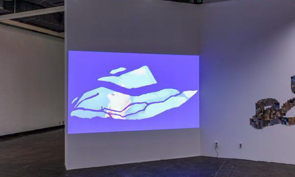
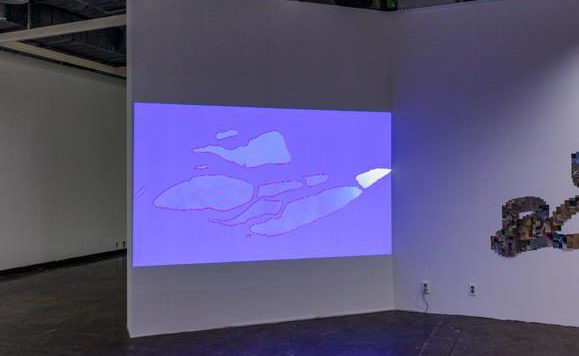
Waterways. Where water passed by.
The water used to flow around île de Nantes freely. Sometimes it seeped into the ground to make it full and disappeared. I drew a map of waterways along the water that is still left.
Île de Nantes is at the center of Nantes.
The formation of these islands has changed over the years, in the process of building several bridges of soil and cement that now connect them.
Search the strata of this space containing the history of Nantes.
Near the development area
I walked along the edge of an island drawn on a map of Nantes in 1759. I recorded what existed between the islands. Perhaps the water couldn’t say anything while the gap was filled in. Silence is the virtue of something that has the potential for development.
I imagined the image of old Nantes.
I walked along the waterways that are no longer there and stepped on the spirit of the water.
Waterways. Where water passed by.
The water used to flow around île de Nantes freely. Sometimes it seeped into the ground to make it full and disappeared. I drew a map of waterways along the water that is still left.
김태희
일 드 낭트(île de Nantes)는 낭트의 중심이다.
크기가 다양한 섬 사이를 여러 개의 다리가, 흙이, 시멘트가 연결하면서 그 모양을 바꿔왔다.
섬 사이.
낭트의 역사가 담긴 이 공간의 지층을 더듬어본다.
개발 접경지대
1759년 낭트 지도에 그려진 섬의 가장자리를 따라 걸었다. 지금 섬 사이에 존재하는 것을 기록했다. 그 사이가 야금야금 메꾸어질 동안 아마도 물은 아무 말도 할 수 없었을 것이다. 침묵은 개발 가능성이 있는 자의 미덕이기 때문이다. 처음 낭트의 모습을 떠올린다.
사라진 물길을 따라 걸으며 수신(水神) 밟기를 한다.
물길, 물이 지나간 자리
물길은 일 드 낭트(île de Nantes)를 자유롭게 둘러 흘러나가곤 했다. 가끔은 땅속에 스며들기도 하고, 가득 찼다가는 영영 사라지기도 했다.
아직 낭트에 남아있는 물을 따라 물길 지도를 그려본다.